Gunung Jerai (Gunung means Mount in Malay) is a 1217 m high mountain on the mainland of Peninsular Malaysia, just to the north of Penang Island, and can be clearly seen from most parts of Penang and the surrounding region in Kedah. It was formerly called Kedah Peak due to it being the tallest peak in Kedah, and a prominent landmark in that part of Malaysia. The mountain is an isolated sandstone peak in a relatively flat landscape.
A road leads to the top from the foot, with its starting point easily accessible from the nearest town, Gurun (just follow the signboards). At the end of the road, sited at the peak, stand some fenced-up telecommunication towers. There are nice, panoramic views of the flat coastal plain of Kedah from the top of the mountain, where you can glimpse the “rice bowl” of Malaysia.
Background
The mountain and its surroundings such as the Bujang Valley have a long history of human settlement, evidenced by many archeological remains, and formed part of a thriving Hindu-Buddhist kingdom, thousands of years ago. There are also many legends and folklore surrounding Gunung Jerai, making this mountain all the more interesting to explore for the intrepid visitor, along with that other mountain peak in Malacca, Gunung Ledang (or Mt. Orphir), also another area steeped in legend and history. The summit of Gunung Jerai is also said to be the site of some ancient Hindu stupa ruins.
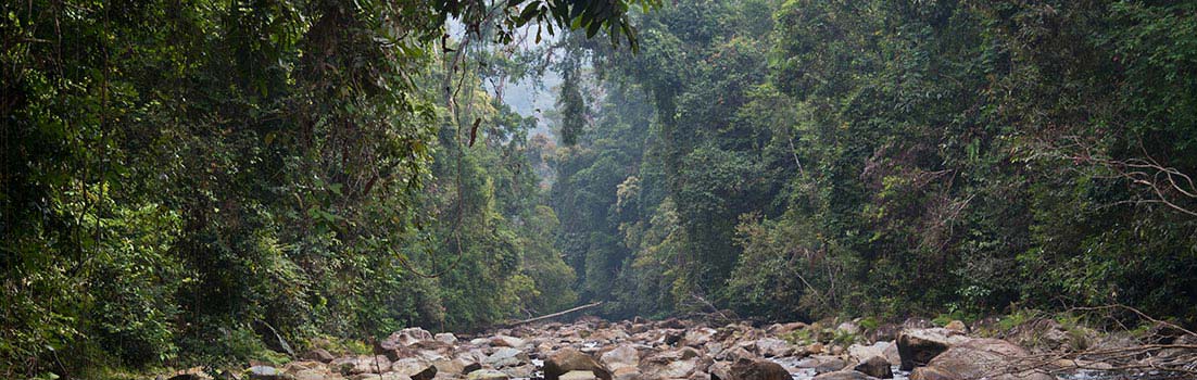
The forest of Gunung Jerai (at the base and lower foothills) appears to be mostly cloaked in old growth dipterocarp forest, although with such a long history of human presence and activities in the general area, you can expect a mosaic of secondary and primary forest at the fringes. Several waterfalls that tumble down the mountain can be visited at the recreational forest parks around the foot.
The following photos below are all scans taken from my photos from the late 1990s.
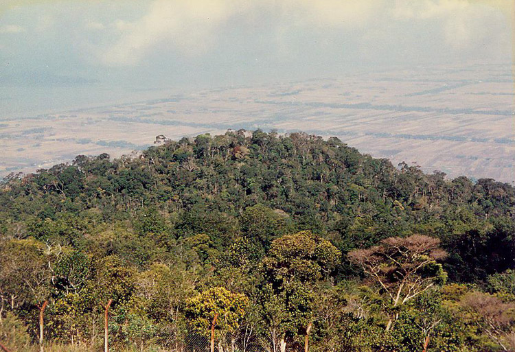
The view from the resort area, which is at around 1100 meters asl. The montane forest seen below is rich in coniferous species. The island seen faintly in the distance (upper left) is Pulau Bunting.

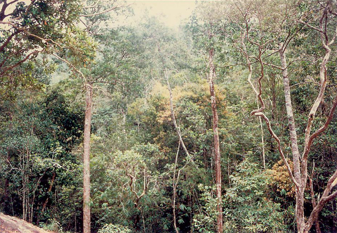
The forest at the upper elevations on Gunung Jerai is upper montane forest that is quite open and consists of low trees.
It is the upper part that draws the most interest though, for Gunung Jerai contains perhaps the most accessible upper montane forest in all of Peninsular Malaysia, which is normally only found at elevations exceeding 1600 m above sea level. This is a short stature forest (canopy height averaging 3-15 meters), and dominated by trees of Dacrydium, Podocarpus, and Leptospermum spp. As you drive up the mountain, you will notice this upper montane ericaceous forest start to appear quite abruptly around 800-1000 meters, appearing above the hill dipterocarp forest.
Myths and attractions
A good way to appreciate the natural environment of Gunung Jerai (if you are fit), is to use the Tangga Kenari (Kenari Stairway), which starts at the foot, and leads all the way up to the resort. This is a series of concrete steps that consist of 1300 steps in total.
There are several attractions on Gunung Jerai, such as a forestry museum sited at a recreational spot (Sungai Teroi Recreational Forest) halfway up the mountain, an old well called Telaga Tok Sheikh (Tok Sheikh Well), and an open, lightly wooded area called Padang Tok Sheikh (Tok Sheikh Field) – both named after a prominent Muslim missionary during the Middle Ages.

The strange rock formation called Batu Kapal. According to locals, this spot is home to elves, and people have gone missing here!
A famous rock formation near the resort area is the Batu Kapal (Ship Rock), which resembles the outline of a ship, and is said to be formerly a ship that was cursed to be turned into stone by a Sang Kelembai, a mythical demon that turns things into stone, and is said to inhabit some dense forest areas in Malaysia. This huge rock formation has water flowing out from its base as well, and trees growing on its flat top.
Walking on it, some spots sound like they are hollow, and there are some striations on the rock surface that resemble wooden planks on a ship. Nearby the Batu Kapal is a waterfall, Alur Naga Waterfall, that has a legend of a dragon that lives in the cave behind the waterfall.
The forest surrounding the Batu Kapal rock formation, as photographed from standing on that rock, is quite tall, likely because of the deeper and wetter soil around here. There might even be a few leeches here, as I recall.

What appears to be a small dried up stream, which may yet flow with water during wet seasons. The nearby Alur Naga waterfall is also dependent on the weather. Dry weather reduces it to a mere trickle.
There is a new resort built near the top of the peak, The Regency Jerai Hill Resort (opened in May 2010), for those who would like to stay at the top and experience the temperate climate, although it never gets too cold or wet to permit mosses to grow in abundance. The new resort replaced the much older resort that was originally there (I stayed there during my visits in the late 1990s).
Flora
One of the main differences between the upper montane forest here and elsewhere, on much higher peaks – is it is much drier here, permitting lots of sedges and grasses to grow on the ground, and creating a more open forest. Also, the branches and roots of the trees, and the ground, are not thickly festooned with mosses like what you would see in Cameron Highlands, for example. The soil is also very thin, often leading to exposed areas of flat sandstone where nothing grows.

The upper montane forest of Gunung Jerai. Those trees are likely to be Leptospermum flavescens. The substrate is very thin as you can see, leading to exposed bedrock in places.

The soil has high quartzite/silica content, as evidenced by the white colored trail. This soil is very poor in nutrients, besides being very thin. Most of the soil is probably peat or decaying plant matter, accumulated over eons.
From the lowlands all the way to the upper montane zone on Gunung Jerai, the Malayan kauri tree, Agathis borneensis grows. This conifer is easily the biggest tree in the montane forest here, capable of reaching heights of anywhere between 30-50 meters tall. It is related to the more famous New Zealand kauri (Agathis australis).
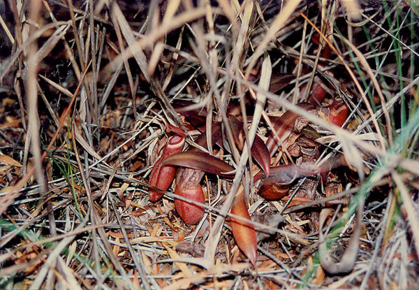
Nepenthes albomarginata on the forest floor.

A pitcher of Nepenthes albomarginata. They occur in a few colors, but are recognizable from the light colored “collar” just below the peristome, or “lip” of the pitcher. Termites are attracted to, and feed on the surface tissue of this white band, and thereby fall into the pitcher.
The montane forest around the peak is also home to a species of pitcher plant, Nepenthes albomarginata, which grows quite abundantly in the more exposed, open areas. Pitcher plants are well known for having great variation even within the same species, and here, the N. albomarginata are colored red; elsewhere they are frequently of a different color.

January 6, 2020 at 4:22 am
I would like to cite this article, is it okay if i write it as Rainforest Journal since no proper author’s name was given. Tq.
January 6, 2020 at 8:14 am
@Afi
Yes, you may cite as Rainforest Journal. Thanks.
November 12, 2025 at 10:24 am
Do you have any photos of the old rest house on Gunung Jerai?
November 13, 2025 at 2:21 pm
@Mike Gibby
Sorry, I don’t. Are you referring to the resort at the peak? They have rebuilt it as far as I know.
June 5, 2026 at 2:28 am
I was referring to the original bungalow, built in 1922 and also known as a sanatorium – it still survives today in the centre of the new ‘resort’ though nothing is made of its history by the present resort
June 7, 2026 at 11:51 pm
I’m trying to collect as much information as possible about the original resthouse / bungalow – if you have any memories I’d be really grateful if you can share them
June 11, 2026 at 9:02 pm
@ Mike Gibby
Sorry, I really don’t have any other info on the original resthouse. I think the best thing you can do is visit Gunung Jerai yourself and ask around, like maybe asking the resort manager. By the time I visited in the late 1990s, the old resthouse was already demolished and there was a newer resort there called Kedah Peak Resort, that was further redeveloped as The Regency Jerai Hill Resort in 2010.
June 20, 2026 at 4:10 am
Thanks JungleBoy!
I have visited the modern resort a couple of times recently, but (most of) the staff there are young and aren’t really aware of the previous ‘versions’ of the resort.